
lower don lands
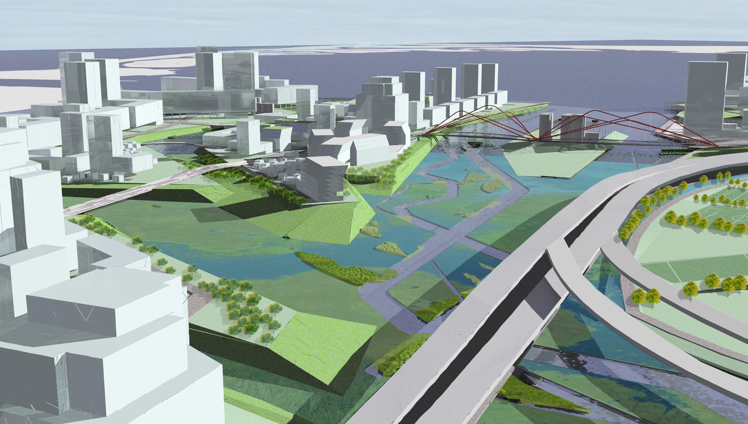
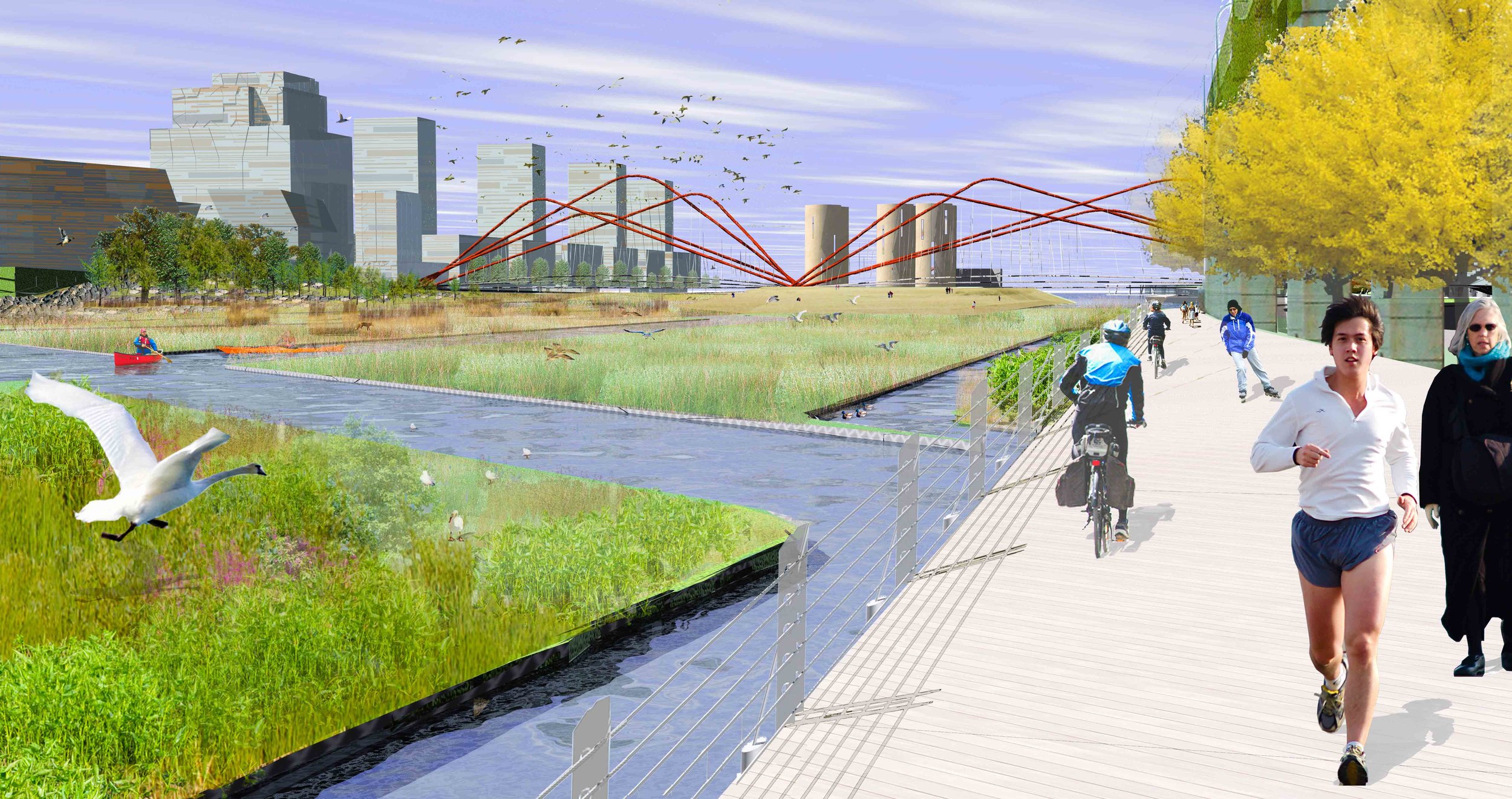
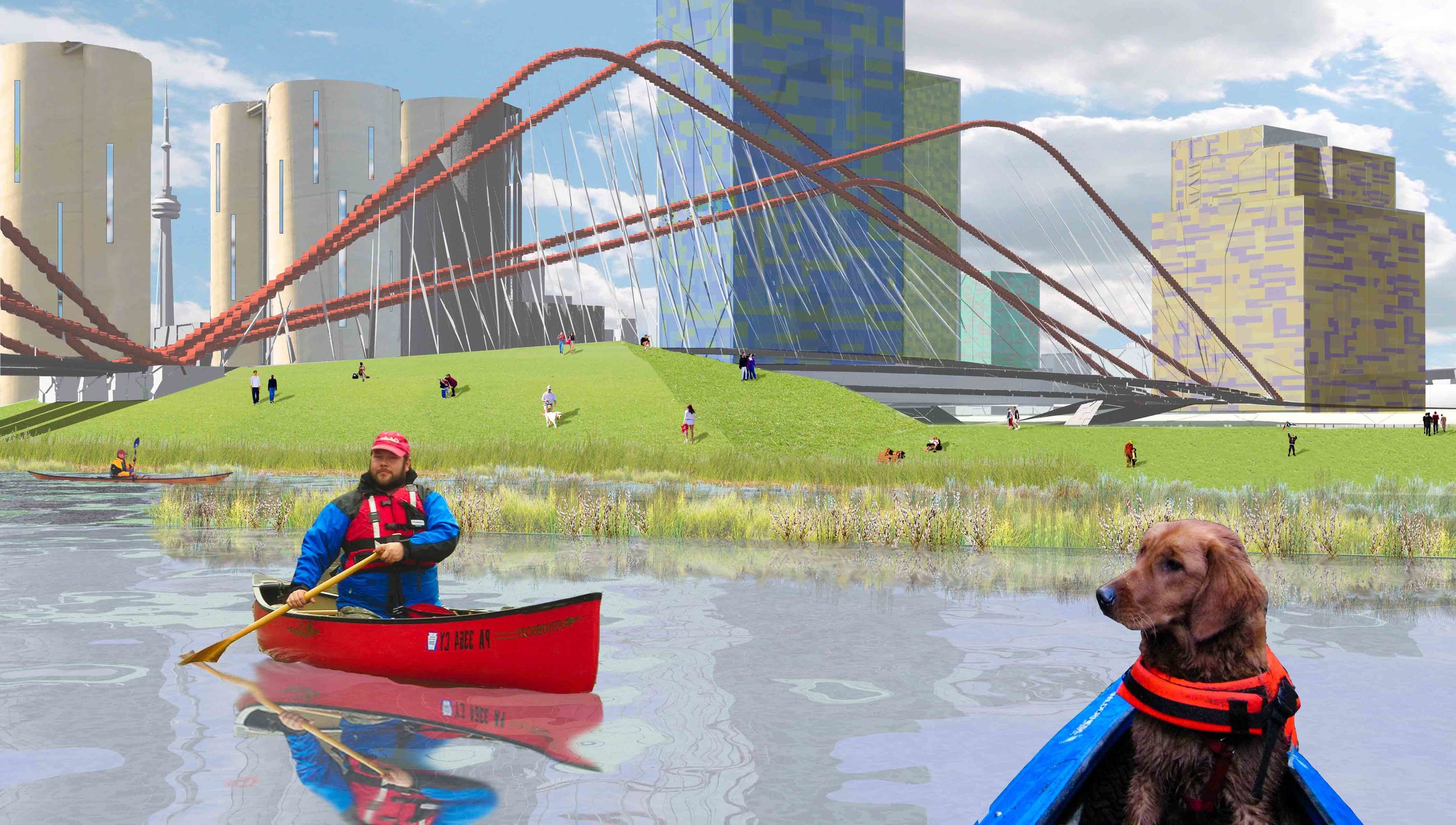
The Lower Don Lands proposal is the product of an invitational, international design competition whose purpose was to re-imagine a 300-acre waterfront parcel characterized by a tangle of transportation infrastructure, a channelized and deadened river, and large territories of underutilized brownfields and former industrial portlands. The project addresses two important goals: to provide an iconic identity for the Don River that takes into consideration key flood protection and habitat restoration requirements of the river mouth; and to establish a comprehensive urban design framework that integrates new development, bold and imageable transportation infrastructures, dynamic new open spaces, and robust, multi-modal circulation networks.
The proposal begins with the ecology and hydrology of the river, manifest in a series of soft infrastructures that spawn a recolonization of the expanded river mouth. This landscape infrastructure is then threaded through the dense but porous urban fabric, giving rise to new types of civic spaces fully integrated with the workings of the larger reconstituted environment. Existing infrastructures are re-tooled, fragments from the site's industrial past are given new life. This is the new green city, in both image and in performance: a sustainable metropolitan district with unique, dynamic, engaging, world-class neighborhoods and open spaces.

Timeline
2007
Status
Completed
Size
300 acres
client
Waterfront Toronto
location
Toronto, Ontario
TEAM
Stoss
Brown + Storey Architects
ZAS Architects
Nina-Marie Lister
Brookner Studio
Kidd Consulting
Applied Ecological Services
Moffatt + Nichol
Arup
Pine + Swallow Associates
Nitsch Engineering
ConsultEcon


