
Nantucket coastal resilience plan
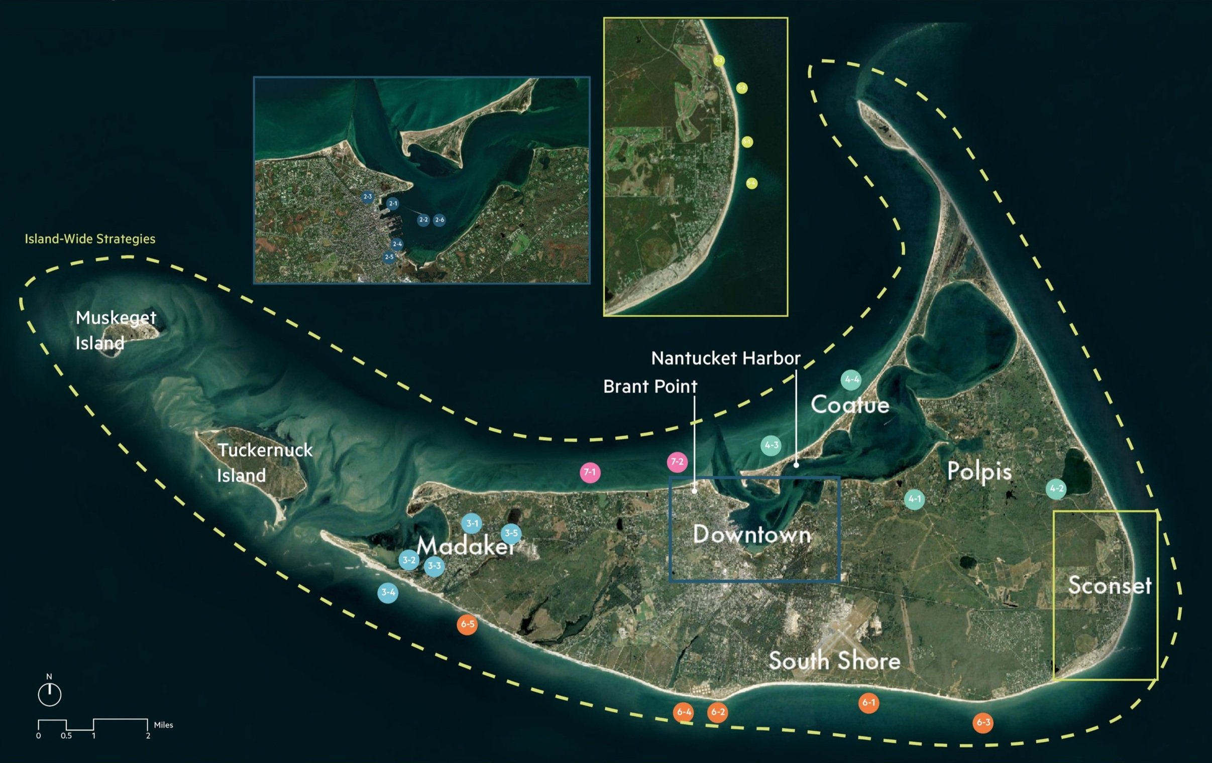
Stoss collaborated with a team led by Arcadis on an island-wide resilience plan for Nantucket that addresses climate-related hazards and sea level rise. Stoss led the analysis of ecological resources and conditions.
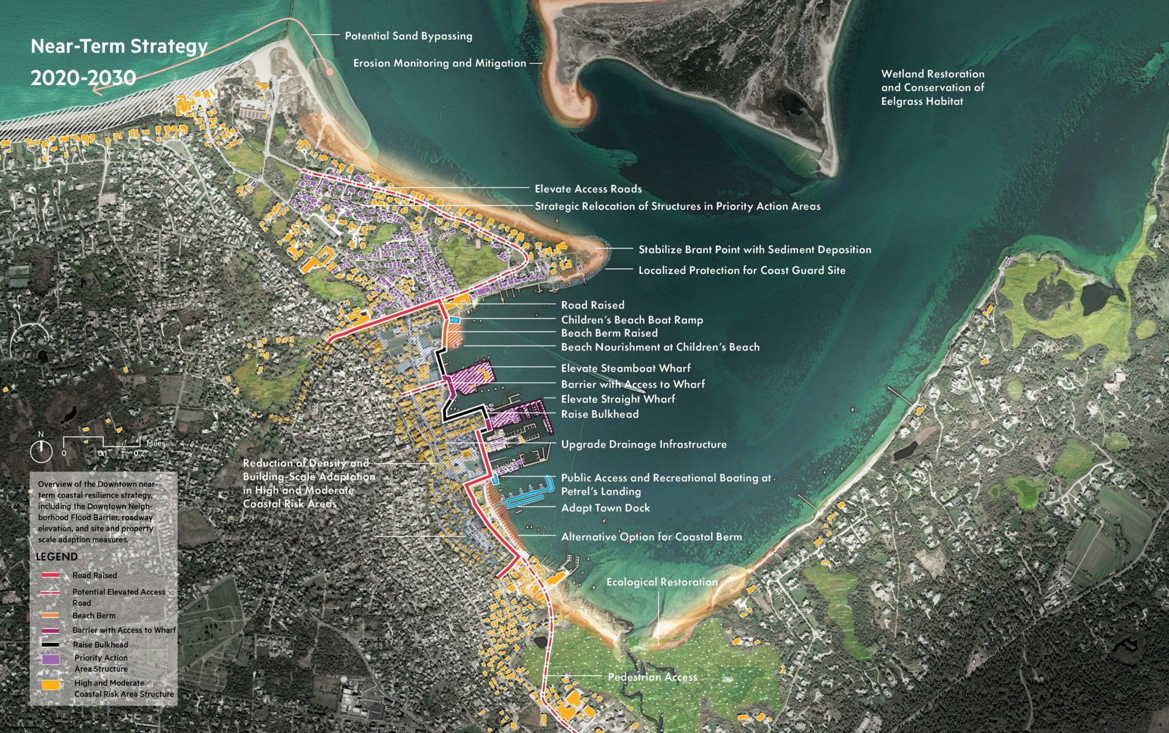
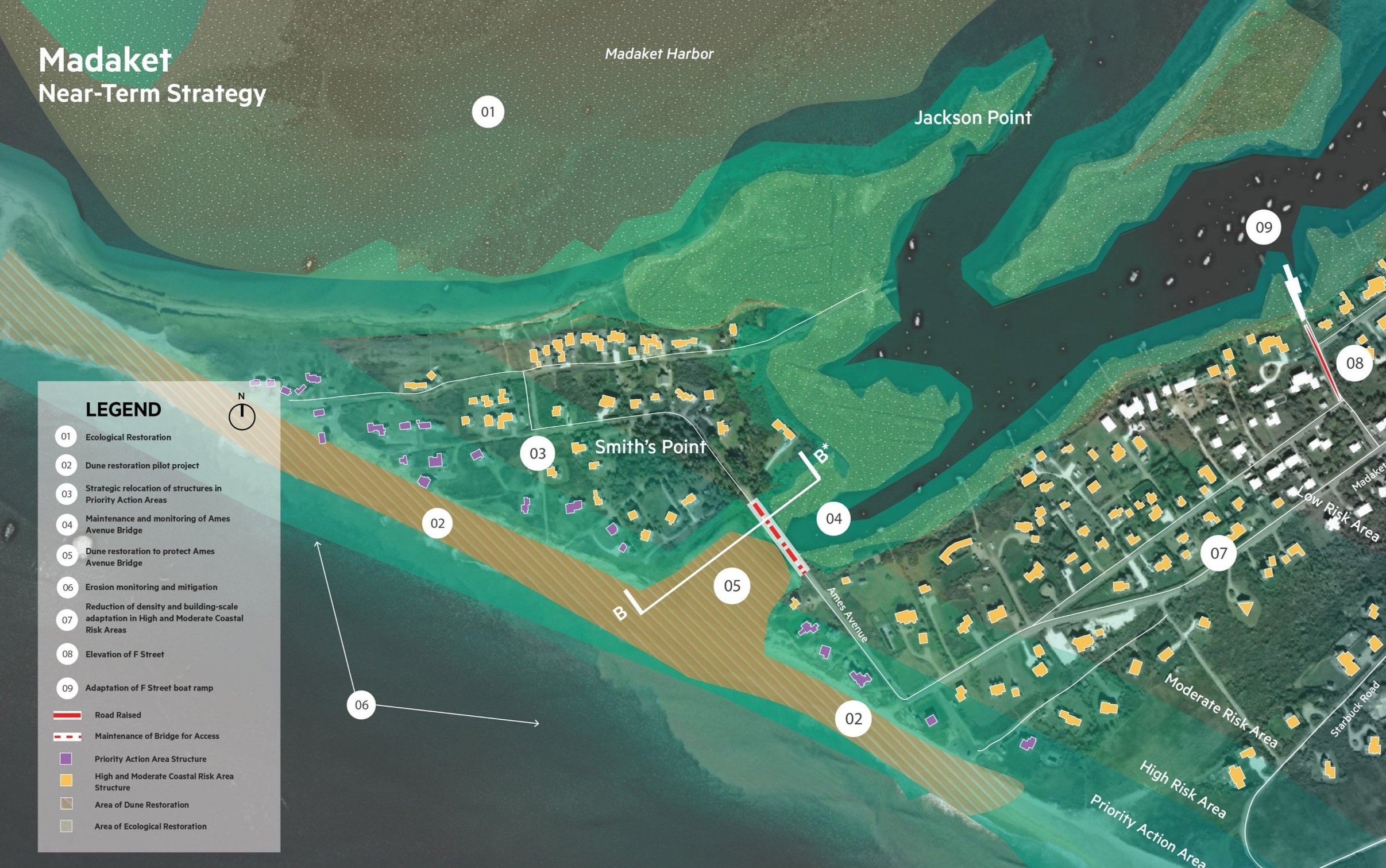
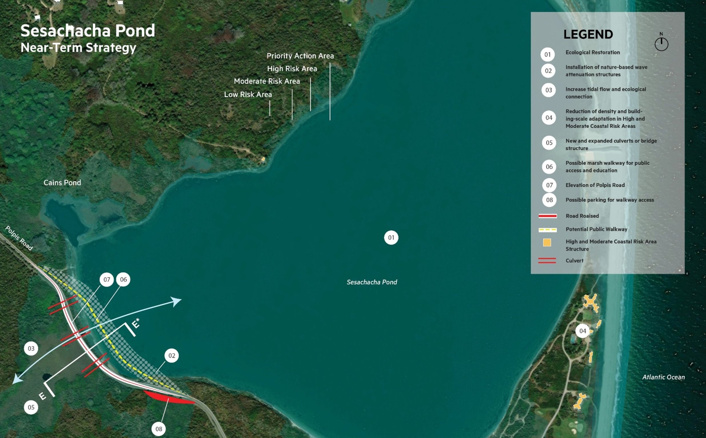
The plan anticipates near-term risks as well as projections out to 2070; and considers Mean Monthly High Water (MMHW), 1% storm events, and erosion. The design team studied a series of locations including the historic Downtown, Madaket, Polpis Harbor, Coatue, Sesachacha Pond, Siasconset, and the South and North Shores. A range of implementation strategies are considered at a conceptual state, including both hard and soft engineering. Possible approaches that may be used at different locations include adapting (living with water), protecting (building with nature), or relocation.
The multidisciplinary team includes ONE Architecture & Urbanism, who is leading the analysis of infrastructure and the most urbanized areas of the island, and The Craig Group, who is leading the analysis of historic assets. The team participated in a series of listening sessions to engage with local agencies and hosted open houses for public input. Close collaboration with Nantucket’s Coastal Resilience Advisory Committee (CRAC) and the Town’s Natural Resources Department allowed for an open process and discussion so that the 42 proposed design strategies correspond to the island’s most pressing concerns and needs.
Timeline
2020-2021
Status
Complete
Size
80 Sq. Miles
client
Town of Nantucket, Department of Natural Resources
location
Nantucket, MA
TEAM
•Arcadis
•ONE Architecture + Urbanism
•Lisa Craig Group
•Town of Nantucket Coastal Resilience Advisory Committee


